Geological 3D Models
Geological 3D models are used to describe the stratigraphy and structure of the subsurface and are the basis for reservoir simulations. For the compilation of a 3D model, sound knowledge of the geological underground is required. This includes precise stratigraphic information (depth layering sequence, age determination), structural knowledge (position of depth, displacements and age of faults) and other important rock properties such as lithology, porosity, permeability or petrology. Most 3D models are based on high-resolution 2D or 3D seismic data, a variety of drilling data, and other investigation methods.
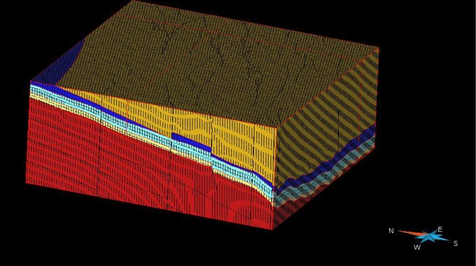
A 3D model represents the layers to be examined with the up and down bounding surfaces and divides the space between them into geometric bodies, which can be assigned a property as required. The spatial distribution of this property is now determined for each body applying statistical methods. For example, porosities or permeabilities can be represented spatially.
- Data acquisition and preparation for the compilation of geological 3D models
- Compilation and evaluation of geological 3D models
- 3D models as basis for reservoir simulations
3D models serve to improve the spatial visualisation of the geological structure of an area or aquifer system and form the basis for reservoir simulations